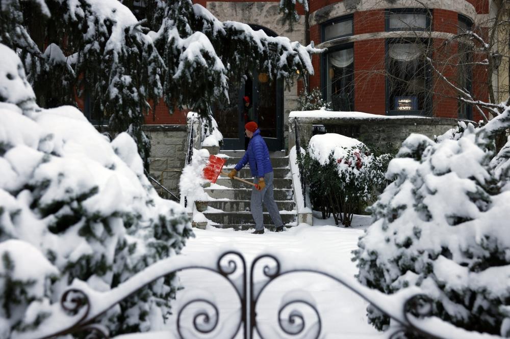
Another Icy Storm To Hit More Than 20 US States This Week
A new, wide-reaching storm is forecast to develop over the central United States on Wednesday night and Thursday, which may bring wintry weather to more than 20 states through Saturday - including areas less accustomed to harsh winter weather and places that may experience their biggest snowstorm in several years.
It comes after the season's first major and widespread winter storm brought dangerous conditions from the Plains to the Mid-Atlantic over the weekend through Monday. Depending on how the systems fueling the snow develop, stormy conditions may also return to places hit earlier in the week. There is a small chance for lots of snow into the weekend, though the forecast will become clearer in the coming days.
Wintry precipitation is forecast to develop in northern and western Texas, New Mexico, Oklahoma, Kansas, Colorado, northern Louisiana, Arkansas and Missouri on Thursday. Several inches of snow are possible around these places from Thursday into Friday, creating hazardous travel conditions and potentially leading to flight delays, cancellations, and school and business closures.
Cities that may experience accumulating snow and/or ice include Dallas-Fort Worth, Abilene and Paris in Texas; Roswell, New Mexico; Oklahoma City and Tulsa; and Fort Smith, Fayetteville and Little Rock in Arkansas.
Snow falls as Capitol Police officers stand guard at fences outside the US Capitol on Monday in Washington. (Photo by Jabin Botsford/The Washington Post)
On Friday, accumulating snow may spread into many more states, including Mississippi, Alabama, Georgia, Tennessee, Kentucky and the Carolinas. From there, snow may again fall in the Mid-Atlantic and Northeast on Friday night and Saturday.
Exactly how much snow and/or ice falls depends on where the rain-snow line sets up. This important dividing line between frozen and liquid precipitation depends on the exact storm track, which is uncertain as of early Tuesday.
The storm will be followed by very cold temperatures in the single digits and teens across the central states over the weekend.
What to know about the snow
A complex interaction of three disturbances in the upper atmosphere will form the storm. As of early Tuesday, two of these systems were over the North Pacific, while a third was over California, fueling a dangerous wind event through Wednesday for parts of the state. Exactly how the systems come together, which will become clearer over the next day, will determine the weather over central states Thursday and southern states Friday.
For now, the highest chance for accumulating snow from late Thursday into early Friday extends from near Dallas-Fort Worth northeastward across Texas into southeastern Oklahoma and Arkansas. This zone has a moderate to high chance of receiving more than three inches and some chance of receiving more than six inches.
The last time Dallas recorded a snow depth of at least three inches was in February 2021; before that, it was March 2015. The city's biggest snowstorm on record occurred in February 2010, when more than a foot fell in two days.
In Little Rock, the last time a snow depth of at least six inches was measured was in February 2021; before that, it was January 2016.
Farther east, the last time Tupelo, Mississippi, reported a snow depth of at least three inches was nearly 10 years ago in February 2015.
From Friday into Saturday, the snow will spread eastward. While the rain-snow line is uncertain, northern Mississippi, northern Alabama, northern Georgia, Tennessee, Kentucky, Indiana, Ohio, West Virginia and parts of the Carolinas could all receive accumulating snow.
Weekend snow scenarios
There's a low chance the storm could rapidly intensify along the Eastern Seaboard on Saturday, which could bring lots of snow.
This would require the three disturbances forming the storm to interact in a very specific way, forming a strong coastal storm know as a nor'easter.
The more likely scenario is that the storm continues to slide eastward Friday night and Saturday, bringing light to moderate snow to the Mid-Atlantic, including Washington, DC, and the Northeast.
The storm's ingredients - the disturbances in the upper atmosphere - will all be over land Wednesday. This means that they will be sampled by weather balloons and aircraft flying near them. That's when data will be able to feed into the weather models, leading to more accurate forecasts.
How cold could it get?
For Texans, the snowy forecast may trigger memories of the deadly February 2021 Arctic blast, which the power grid couldn't withstand, leaving millions without the ability to heat their homes.
Since then, Texas has bulked up its power grid by adding giant batteries, windmills and solar panels to better weather storms and chills.
During the polar plunge in mid-February 2021, more than 30 states experienced subzero temperatures, including Texas. But temperatures forecast over the next two weeks, while very cold at times, look unlikely to reach the low levels experienced nearly four years ago.
Texas may experience temperatures in the 10s. Snow-covered central states and the Appalachians and much of the rest of the northern tier of states could see temperatures in the single digits and below zero.
Another round of cold, Arctic air may spill southward across the country during the week of January 13, followed by yet one more during the week of January 20.
Winter storms will occasionally swirl across the country during the period, with frequent snowfall in the Great Lakes region.

Legal Disclaimer:
MENAFN provides the
information “as is” without warranty of any kind. We do not accept
any responsibility or liability for the accuracy, content, images,
videos, licenses, completeness, legality, or reliability of the information
contained in this article. If you have any complaints or copyright
issues related to this article, kindly contact the provider above.


Comments
No comment