Geological Revelation! Zealandia, Earth's 8Th 'Continent', Discovered After 375 Years
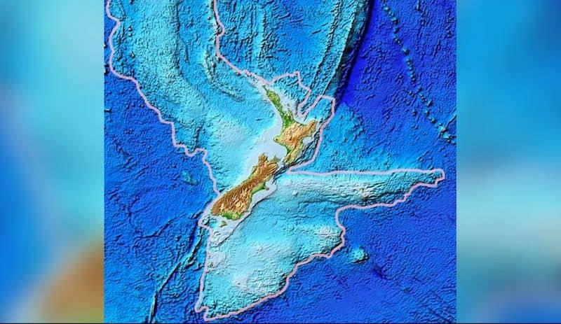
According to a report by the BBC, Zealandia emerges as a vast continent spanning a staggering 1.89 million square miles (4.9 million square kilometers), making it approximately six times the size of Madagascar. The team of scientists involved in this groundbreaking discovery assert that, with the inclusion of Zealandia, the world now boasts a total of eight continents. This latest addition is a standout in the records, for it stands as the smallest, thinnest, and youngest continent on Earth.
Notably, Zealandia primarily remains submerged beneath the ocean's surface, with a mere fraction of its landmass surfacing as islands, reminiscent of New Zealand itself. Andy Tulloch, a geologist hailing from the New Zealand Crown Research Institute GNS Science, who played a pivotal role in this discovery, aptly remarked, "This is an example of how something very obvious can take a while to uncover," as reported by BBC.
The pursuit of knowledge about Zealandia has always posed a considerable challenge for scientists. To gain insight into this hidden continent, researchers have turned to the examination of collections of rocks and sediment samples retrieved from the ocean bed. These samples originate from a variety of sources, with some collected during drilling expeditions and others procured from the shores of islands in the surrounding area.
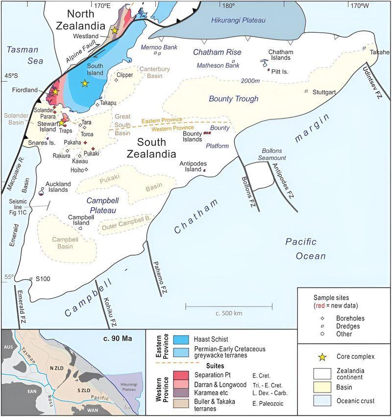
Physreported that the study of these rock samples uncovered intriguing geologic patterns in West Antarctica, hinting at the potential existence of a subduction zone near the Campbell Plateau, situated off the western coast of New Zealand. Notably, despite these patterns, the researchers did not detect magnetic anomalies in this area, which contradicts theories pertaining to a strike-slip fault in the Campbell Fault.
The newly refined map of Zealandia not only pinpoints the location of the magmatic arc axis of this continent but also reveals other significant geological features previously concealed from view.
Zealandia's origin can be traced back to the ancient supercontinent of Gondwana, which took shape approximately 550 million years ago, uniting all the landmasses in the southern hemisphere into a singular landmass.
Legal Disclaimer:
MENAFN provides the
information “as is” without warranty of any kind. We do not accept
any responsibility or liability for the accuracy, content, images,
videos, licenses, completeness, legality, or reliability of the information
contained in this article. If you have any complaints or copyright
issues related to this article, kindly contact the provider above.
Most popular stories
Market Research

- 1Inch Unlocks Access To Tokenized Rwas Via Swap API
- Financewire And Tipranks Partner To Redefine Financial News Distribution
- Ethereum-Based Defi Crypto Mutuum Finance (MUTM) Raises Over $16 Million With More Than 720M Tokens Sold
- Kintsu Launches Shype On Hyperliquid
- BILLY 'The Mascot Of BASE' Is Now Trading Live On BASE Chain
- Kucoin Partners With Golf Icon Adam Scott As Global Brand Ambassador


Comments
No comment