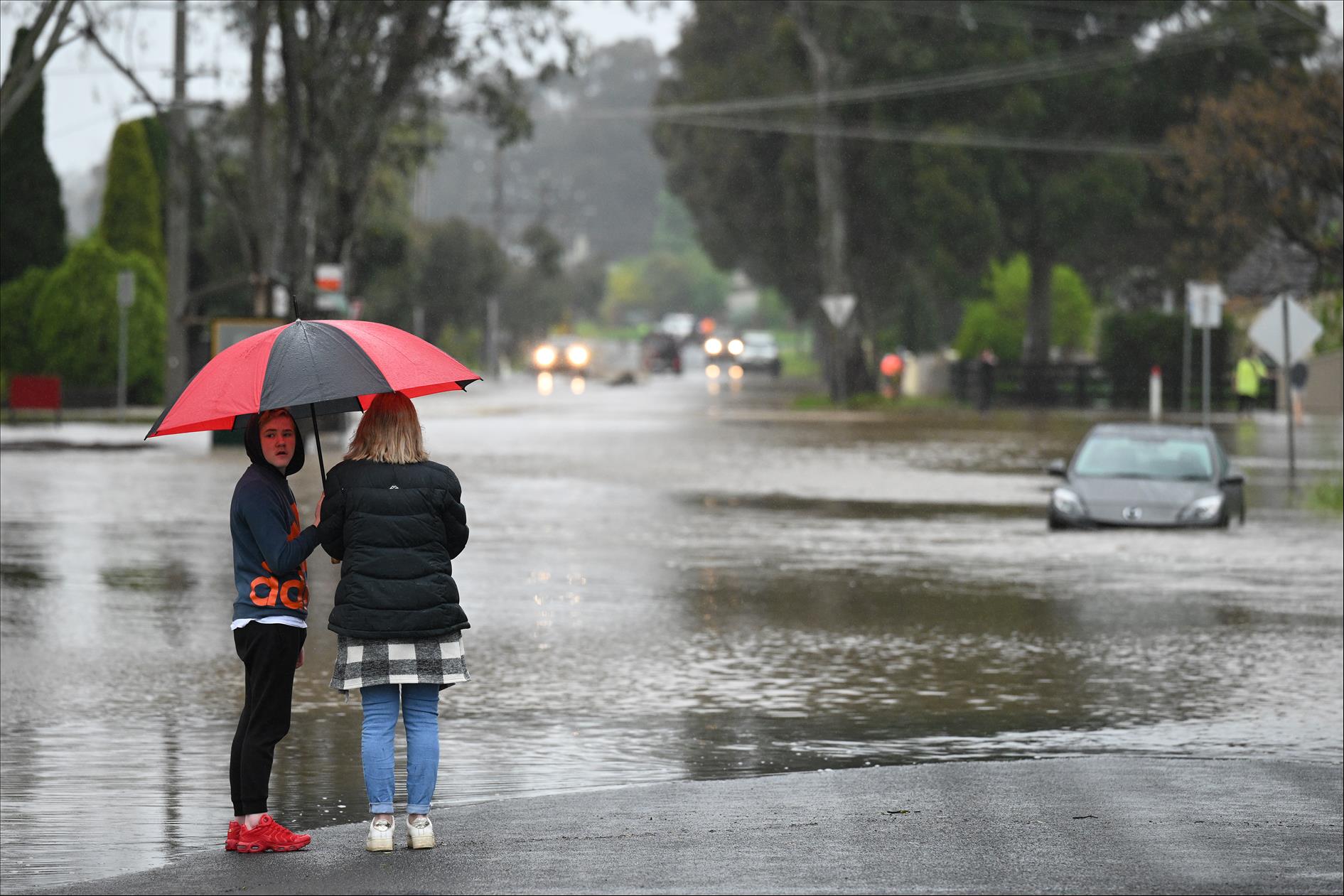
(MENAFN- The Conversation) Heavy rain and floods have once again hit towns and suburbs across eastern Australia. Some areas have been devastated, while others have been spared the worst. While climate drivers like La Niña make extreme wet weather more likely, what explains when and where the storm clouds deliver a deluge?
Extreme weather, such as the heavy rainfall battering eastern Australia, is like military conflict. In war, the enemy's behaviour depends on the decisions of many actors: from generals and lieutenants down to individual soldiers. Similarly, heavy rainfall is the culmination of diverse physical processes, from the planetary scale down to the microscopic.
A strategic defence requires anticipating how the enemy will behave across this hierarchy. To continue with the military analogy, this is how we can explain the weather offensive of the past week.
The generals command the offensive
Processes on a yearly or planetary scale, such as and the , are like generals. Over the , these two generals hatched a plot of around northern and eastern Australia.
La Niña promotes easterly winds by strengthening the Pacific equatorial oceanic and atmospheric circulations. The Southern Annular Mode moves the belt of high- and low-pressure systems you see on the evening news further south, reducing their obstruction of the easterly winds.
Stronger easterlies help humid air over the Pacific advance into the eastern states and feed storm clouds: a cunning plan.
Read more:
3 lieutenants in action during floods
Daily and state-scale processes, such as the pressure patterns mentioned above, are like lieutenants. These lieutenants decide the particular day, and states, to attack. At least three lieutenants have been in action during the current flooding.
The first was a . Air wants to move from high to low pressure but is confounded by Earth's rotation. Southern hemispheric winds thus travel anticlockwise around highs and clockwise around lows.
The New Zealand high reinforced the general's stronger easterly winds, directing humid air toward Victoria and New South Wales.
The second lieutenant was an . Through , this undulation promoted upward motion over the south-eastern states, supporting the development of storm clouds.
The third lieutenant was a . This low dragged cold Antarctic air clockwise around itself, forming a . This cold front triggered the storm clouds as it advanced through Victoria.
These three lieutenants, supported by the strategy of their generals, together conspired to inflict the heavy rainfall on October 13 in the south-eastern states. Tactically devious.
Read more:
Soldiers attack each suburb and town
Hourly and suburb-scale processes, such as storm clouds, are like the individual soldiers: they decide the particular suburb to attack. A storm cloud features an intense updraft .
These updrafts are largely powered by the condensation of water vapour onto dust particles – a microscopic process. Witnessing a growing storm cloud is like watching an explosion, except the energy source is condensation, not combustion.
A soldier's behaviour typically reflects the designs of their lieutenants, but they are . In a firefight, they make their own decisions and can .
Soldiers may march single file through a city, successively attacking the same building as they pass. Or they may march many abreast, attacking more buildings but with reduced firepower. Squadrons of .
The suburb of Maribyrnong, Melbourne, is one of many places where intense local storms led to flooding. Nathan Coote/AAP Read more:
So how can we predict these events?
Because the enemy organises across large, medium and small scales, so must we. To help with this, the Australia Bureau of Meteorology uses a computer simulation called the . It's akin to the in computer games such as Halo.
The simulation is“unified” because it uses the same basic infrastructure to predict the atmosphere's behaviour at all scales, from generals down to soldiers.
Using the Unified Model we can predict lietenants' behaviour – the high- and low-pressure patterns – . It took nearly a century of global scientific effort to build this capability.
Anticipating the schemes of generals – processes such as La Niña – is . The bureau generates La Niña predictions by and counting how often La Niña persists and how often it decays to estimate its most likely behaviour. Current simulations La Niña will likely decline over spring and conclude early in 2023.
It is similarly difficult to predict the behaviour of individual soldiers – the individual storm clouds. Eventually, we hope to be able at least to predict how these clouds organise – whether they will march single file or abreast.
The bureau pursues this goal by running complex Unified Model simulations, which explicitly simulate the movement of individual storm clouds over each capital city. These – a bit like the film Inception (a dream within a dream).
It will take decades, if not centuries, before we can seamlessly anticipate the behaviour of the generals and soldiers of the weather as well as we do for the lieutenants. Developing this capability requires sustained support for diverse scientists across many specialities.
While the threats are significant, we now have a deep grasp of the behaviour of lieutenants and are making promising progress with generals and soldiers. Coupled with the success of the unified approach, there are grounds for optimism.


Comments
No comment