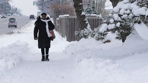
US Braces For Freezing Weather Fueled By Triple Polar Vortex: What Is It? How Cold Will December Get?
“This week will mark the first of probably three such rounds,” AccuWeather Lead Long-Range Meteorologist Paul Pastelok said on the company's website.“Another cold blast is likely next week and a third the week after that. The waves of Arctic air will lead to significant surges in energy demands.”
How cold will December get?Parts of the Upper Midwest and Northern Plains are already feeling the effects of air spilling in from Canada. On Thursday, December 4, wind chills are expected to plunge between minus 10 and minus 25 degrees, with the intense cold spreading into the eastern US through Friday, December 5.
Also Read | Winter storm warnings hit US-which states have highest risk of extreme rainfall?As this Arctic surge presses south, bursts of snow, flurries and powerful snow squalls may accompany the front, particularly across the Great Lakes and the northern Appalachians, AccuWeather noted.
What is triple-dip Polar Vortex?The polar vortex is a broad ring of low-pressure upper-air winds that normally circles the Arctic and contains the coldest air near the North Pole. While strongest in winter, parts of this circulation can occasionally weaken, allowing a segment to break off and slide south. When this happens, frigid air can spill into the US, Europe or Asia. Under typical conditions, the jet stream keeps this system locked in place near the pole.
Also Read | Polar vortex pattern shift shift signals sudden weather change in USAs temperatures fall, the combination of cold air and strong winds greatly heightens the risk of frostbite.
The National Weather Service uses computer-based modeling to calculate the wind chill index, which incorporates wind speed measured at five feet above the ground-roughly the level of a person's face-and applies heat-transfer physics to determine how quickly the body loses warmth.
Also Read | US gripped by winter blast: Lake-effect snow, snow squalls threaten travelThe index offers a quick way to assess how dangerous conditions may be when both low temperatures and brisk winds are present. Users can determine the wind-chill value by matching the outdoor temperature with the corresponding wind speed on the NWS chart.
Which regions are at heightened risk?Forecasts suggest that the Central, Midwest, and Eastern US will experience the most severe effects of the incoming Arctic air. Snow, freezing rain, and life-threatening wind chills are likely across multiple states, with the first wave pushing northeast-including the I-95 corridor-between December 3 and 5.
Regions at heightened risk include:Great Plains and Midwest: The Dakotas, Minnesota, Iowa, and Nebraska may see temperatures plummet rapidly and remain bitterly cold for days.
Mid-Atlantic and Northeast: States such as New York, Pennsylvania, New Jersey, and those across New England can expect sharp cold blasts paired with snow or mixed winter precipitation.
South and Southeast: Interior areas may face unusually hard freezes, even as coastal zones stay relatively milder.
Meanwhile, some regions-such as parts of the Mountain West-are expected to escape the worst of the cold compared to surrounding areas.
Legal Disclaimer:
MENAFN provides the
information “as is” without warranty of any kind. We do not accept
any responsibility or liability for the accuracy, content, images,
videos, licenses, completeness, legality, or reliability of the information
contained in this article. If you have any complaints or copyright
issues related to this article, kindly contact the provider above.


Comments
No comment