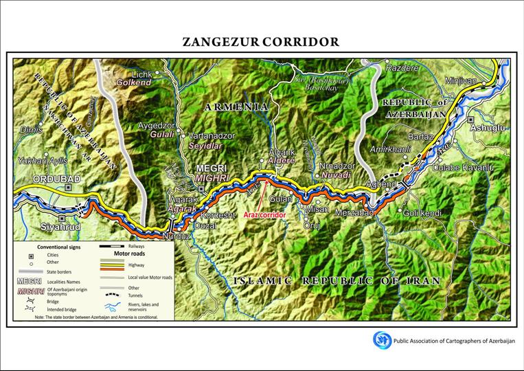
Azerbaijani Cartographers Prepare Map Of Zangezur Corridor
According to the Union's chairman, Mugabil Bayramov, the map was created using high-resolution satellite imagery as its base layer to ensure geographical precision and visual clarity.
Bayramov noted that the map illustrates the relevant sections of Azerbaijan, Armenia, and Iran, including residential settlements, highways, rivers, and mountain ranges along the corridor's route. The Araz Corridor, another key regional transport connection, is also featured on the map.
The cartographic work has been produced in both Azerbaijani and English, highlighting its significance not only for national use but also for international research, academic, and policy reference.
Legal Disclaimer:
MENAFN provides the
information “as is” without warranty of any kind. We do not accept
any responsibility or liability for the accuracy, content, images,
videos, licenses, completeness, legality, or reliability of the information
contained in this article. If you have any complaints or copyright
issues related to this article, kindly contact the provider above.


Comments
No comment