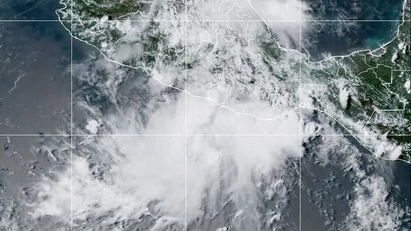
Hurricane Tracker: Tropical Storm Ivo Fades West Of Baja California, Swells Pose Risk To Beachgoers
At 2:00 AM MST, the center of Tropical Storm Ivo was located approximately 335 miles (535 km) west-southwest of the southern tip of Baja California. The system is moving toward the west-northwest at 8 mph (13 km/h), with a gradual turn toward the west and a slight increase in forward speed expected over the next couple of days.
Current intensity & structure
Maximum sustained winds: 40 mph (65 km/h)
Hazards affecting landSurf: Swells from Ivo will continue to affect the southern Baja California peninsula over the next day.
These swells are likely to produce life-threatening surf and rip current conditions.
Residents and beachgoers should follow local advisories from the Servicio Meteorológico Nacional and civil defense authorities.
Operational notesNo coastal watches or warnings are in effect as of this advisory.
Forecast winds and seas in and near active tropical cyclones may vary significantly due to uncertainty in track, size, and intensity forecasts.
Mariners should monitor updates every 6 hours for potential changes in Ivo's size and wind field distribution.
Also Read | Flash flood warning for Southeastern Wisconsin - 5–8 inches of rain brings major Legal Disclaimer:
MENAFN provides the
information “as is” without warranty of any kind. We do not accept
any responsibility or liability for the accuracy, content, images,
videos, licenses, completeness, legality, or reliability of the information
contained in this article. If you have any complaints or copyright
issues related to this article, kindly contact the provider above.


Comments
No comment