Parnotsa To Poonch: Journey Of A Hill Kingdom
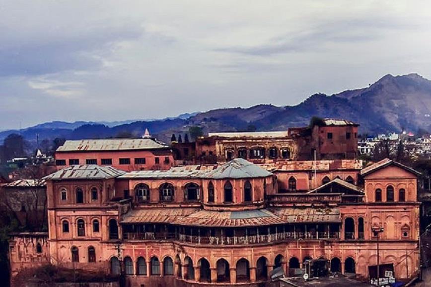
File photo of Poonch Fort
By Shahid Ahmed Hakla Poonchi
Long before borders cut across the Pir Panjal, a fierce hill kingdom called Parnotsa ruled these heights. It rose 3,300 feet above the sea, held tight by ridges that stood like walls against the storms racing up from the plains.
The Poonch Tohi River shaped the early life of this land. Its small streams fed farms, guided settlements, and supported trade. People built homes close to the water and grew their societies in sheltered valleys.
ADVERTISEMENTSurrounded by hills and deep river systems, Parnotsa became organised early. It did not grow into a mighty empire, but it carried its own way of life with confidence.
When the Chinese traveller Hiuen Tsang reached the region in 633 A.D., he found a land already known to traders and pilgrims. He had walked across high passes and through sharp wind before entering the valley. His record shows that the kingdom had a calm and settled character. The mountains guarded it, and the rivers connected it to the world outside.
The region that we call Poonch today stood between the Jhelum and the Chenab. These two rivers were like long arms stretching through ancient trade routes.
Traders, soldiers, and wandering monks often passed through these hills on their way to Kashmir or the plains.
The old state of Parnotsa sat in the valleys of the Poonch Tohi and its many feeders. The Pir Panjal marked the north, Rajapuri or Rajouri lay in the east, the Punjab plains opened in the south, and the Jhelum flowed in the west.
One of the most used old routes from Bhimbar to Kashmir cut through the southeastern corner of this region. This gave Parnotsa natural importance. It became a gateway between two distinct worlds.
The town of Poonch grew on a gentle slope above the right bank of the Poonch Tohi, near its meeting point with the Bitarh. A traveller standing there could watch the valley stretch out like a large bowl surrounded by forested walls.
The town stood midway between Bhimbar and Srinagar, connected by a road that moved through the Suran valley and crossed the Haji Pir Pass. Kotli sat twenty miles away and could be reached by following the river or by climbing the Sona and Nandheri passes through Mankot.
In its present form, Poonch district has six tehsils: Haveli, Mendhar, Surankote, Mandi, Balakote, and Mankote.
To the north and northeast lie Baramulla and Pulwama of the Kashmir valley. To the northwest lie parts now under Pakistan. Rajouri holds the southern side.
After 1947, half of Haveli tehsil and the entire Bagh and Sudhmutta tehsils of the old state went across the Line of Control.
The region carried many names through time. Parnotsa appears to be the earliest. Alexander Cunningham wrote Punacha or Punach. Kashmiris said Proons. Hiuen Tsang recorded Pun nu tso. Moorcroft wrote Prunch or Pruntz. General Court also used Prunch. Mirza Mogal Beg wrote Punja, and the traveller Vigne used Punch.

Legal Disclaimer:
MENAFN provides the
information “as is” without warranty of any kind. We do not accept
any responsibility or liability for the accuracy, content, images,
videos, licenses, completeness, legality, or reliability of the information
contained in this article. If you have any complaints or copyright
issues related to this article, kindly contact the provider above.


Comments
No comment