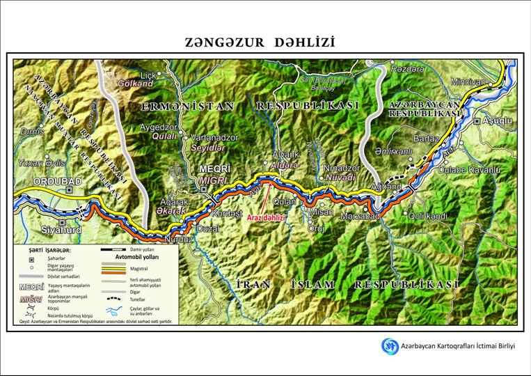
Azerbaijani Public Union Charts Path For Zangezur Corridor With Detailed Map
Bayramov articulated that the foundational layer of the
cartographic representation was synthesized utilizing
high-resolution satellite imagery, thereby guaranteeing an accurate
and intricate depiction.
The cartographic representation delineates pertinent geographical
segments of Azerbaijan, Armenia, and Iran, encompassing urban
settlements, transportation corridors, fluvial systems, and
topographical elevations. The schematic representation additionally
encompasses the Aras Corridor and is accessible in dual linguistic
formats: Azerbaijani and English.

Legal Disclaimer:
MENAFN provides the
information “as is” without warranty of any kind. We do not accept
any responsibility or liability for the accuracy, content, images,
videos, licenses, completeness, legality, or reliability of the information
contained in this article. If you have any complaints or copyright
issues related to this article, kindly contact the provider above.


Comments
No comment