What Is A Flash Flood? A Civil Engineer Explains
Flash flooding is a specific type of flooding that occurs in a short time frame after a precipitation event – generally less than six hours . It often is caused by heavy or excessive rainfall and happens in areas near rivers or lakes, but it also can happen in places with no water bodies nearby.
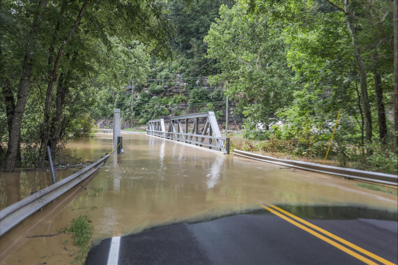
Flash floods happen in rural and urban areas, as in late July 2022 in St. Louis and eastern Kentucky . When more rainfall lands in an area than the ground can absorb, or it falls in areas with a lot of impervious surfaces like concrete and asphalt that prevent the ground from absorbing the precipitation, the water has few places to go and can rise very quickly.
If an area has had recent rainfall, the soil may be saturated to capacity and unable to absorb any more water. Flooding can also occur after a drought, when soil is too dry and hardened to absorb the precipitation. Flash floods are common in desert landscapes after heavy rainfalls and in areas with shallow soil depths above solid bedrock that limits the soil's ability to absorb rain.
Since water runs downhill, rainfall will seek the lowest point in a potential pathway. In urban areas, that's often streets, parking lots and basements in low-lying zones. In rural areas with steep terrain, such as Appalachia, flash flooding can turn creeks and rivers into raging torrents.
A home security video shows floodwaters rising rapidly in Waverly, Tennessee, in August 2021.
Flash floods often catch people by surprise, even though weather forecasters and emergency personnel try to warn and prepare communities. These events can wash away cars and even move buildings off their foundations .
The best way to stay safe in a flash flood is to be aware of the danger and be ready to respond. Low-lying areas are at risk of flooding, whether it happens slowly or quickly and whether it's an urban or rural setting.
It's critical to know where to get up-to-date weather information for your area. And if you're outdoors and encounter flooded spots, such as water-covered roadways, it is always safer to wait for the water to recede or turn back and find a safer route. Don't attempt to cross it. Flood waters can be much faster and stronger than they appear – and therefore more dangerous.
Building for a wetter futureEngineers design stormwater control systems to limit the damage that rainfall can do. Culverts transfer water and help control where it flows , often directing it underneath roads and railways so that people and goods can continue to move safely. Stormwater containment ponds and detention basins hold water for release at a later time after flooding has ceased.
Many cities also are using green infrastructure systems , such as rain gardens, green roofs and permeable pavement, to reduce flash flooding . Restoring wetlands along rivers and streams helps mitigate flooding as well.
Often the design standards and rules that we use to engineer these features are based on historic rainfall data for the location where we're working. Engineers use that information to calculate how large a culvert, pond or other structure might need to be. We always build in some excess capacity to handle unusually large floods.
Now, however, many parts of the U.S. are experiencing more intense storm events that drop significant amounts of rainfall on an area in a very short time period. The recent St. Louis and Kentucky floods were both on a scale that statistically would be expected to occur in those areas once in 1,000 years .
With climate change, we expect this trend to continue, which means that planners and engineers will need to reconsider how to design and manage infrastructure in the future. But it's hard to predict how frequent or intense future storm events will be at a given location. And while it's extremely likely that there will be more intense storm events based upon climate projections, designing and building for the worst-case situation is not cost effective when there are other competing demands for funding.
Right now, engineers, hydrologists and others are working to understand how best to plan for the future, including modeling flood events and development trends, so that we can help communities make themselves more resilient. That will require more, updated data and design standards that better adapt to anticipated future conditions.

Legal Disclaimer:
MENAFN provides the
information “as is” without warranty of any kind. We do not accept
any responsibility or liability for the accuracy, content, images,
videos, licenses, completeness, legality, or reliability of the information
contained in this article. If you have any complaints or copyright
issues related to this article, kindly contact the provider above.


Comments
No comment