




403
Sorry!!
Error! We're sorry, but the page you were looking for doesn't exist.

Severe Heatwave Sweeps North And Central India, Relief Likely Only After May 28
(MENAFN- AsiaNet News) ![]()
![]()
![]()
![]()
![]()
![]()
![]()
North, East and Central India are facing a severe heatwave, with temperatures expected to reach 45°C to 49°C until May 28. Delhi-NCR briefly received relief from duststorms and light rain on May 23, but temperatures quickly climbed back to 41°C-43°C.
The India Meteorological Department (IMD) has warned that severe heatwave conditions will continue across large parts of Central and Northwest India for the next seven days. Eastern and nearby Peninsular India are also expected to face intense heat for the next three to five days. However, temperatures may begin to fall slightly from May 29 onwards.
Weather experts and the India Meteorological Department (IMD) have warned that several states could see temperatures between 45°C and 49°C over the coming days.
Punjab, Haryana, Delhi, Rajasthan, Uttar Pradesh, Madhya Pradesh, Vidarbha, Chhattisgarh, Odisha, Bihar, Jharkhand and Telangana are among the regions likely to face heatwave conditions. Severe heatwave conditions are especially expected in parts of West Rajasthan, East Uttar Pradesh, Madhya Pradesh and Vidarbha till May 27 or 28. Warm nights are also likely in parts of Uttar Pradesh and Vidarbha, making conditions more uncomfortable.
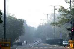
The extreme heat has affected daily life across many regions, especially in cities where roads, buildings and concrete structures are trapping heat even during the night.
In South India, Kerala, Lakshadweep, Tamil Nadu, Karnataka, Telangana, Andhra Pradesh and Rayalaseema are likely to witness rain, thunderstorms and gusty winds till May 30. Kerala and Lakshadweep may receive heavy rainfall during May 24-28. Strong winds reaching up to 70 kmph are also possible in Rayalaseema and North Interior Karnataka.
Eastern states including West Bengal, Bihar, Jharkhand and Odisha are also likely to receive thunderstorms and gusty winds. Sub-Himalayan West Bengal and Sikkim may witness heavy to very heavy rainfall till May 27.
मौसम संबंधी चेतावनीमुख्य बिंदु(i) मध्य और उत्तर-पश्चिम भारत में अगले 7 दिनों तक और पूर्वी और उससे सटे प्रायद्वीपीय भारत में अगले 3-5 दिनों तक ऊष्ण लहर से भीषण ऊष्ण लहर की स्थिति बनी रहने की संभावना है। अधिकतम तापमान में 29 मई से कमी आने की संभावना है।(ii) केरल और लक्षद्वीप,... twitter/Oan1ybzvDz
- India Meteorological Department (@Indiametdept) May 24, 2026
In Northwest India, Jammu and Kashmir, Himachal Pradesh, Uttarakhand, Punjab, Haryana, Uttar Pradesh and Rajasthan may receive scattered rainfall and thunderstorms in the coming days. Duststorms are also likely in isolated areas of Rajasthan.
The IMD said temperatures are expected to remain high across most parts of the country till May 28, before gradually reducing by 2°C to 5°C in several regions by May 29 and 30.
At the same time, several states are expected to receive heavy rainfall along with thunderstorms, lightning and strong winds. In Northeast India, Assam, Meghalaya, Arunachal Pradesh, Nagaland, Manipur, Mizoram and Tripura are likely to receive widespread rain over the next few days. IMD has warned of extremely heavy rainfall in isolated places in Assam and Meghalaya on May 24, while Arunachal Pradesh may also receive very heavy rain on May 24 and 25.
Delhi-NCR received a short spell of relief on Saturday morning after a mild duststorm and light thundershowers passed through parts of the region between 8:15 am and 10:00 am on May 23.
However, the cooler conditions did not last long. By afternoon, temperatures once again climbed sharply and reached around 41°C to 43°C in many areas.
Weather experts say the short rain and duststorm only reduced temperatures for a few hours and did not change the larger weather system affecting the region.
Why temperatures are rising so sharply
Experts say the current heatwave is being driven by two major reasons. The first is the absence of strong atmospheric cooling systems. The second is the usual pre-monsoon heat build-up that develops across north and central India during late May.
Ground weather observations and forecast models from the India Meteorological Department's Global Forecast System show that the main heat zone is expanding across several states.
Between May 25 and May 30, another stronger phase of the heatwave is expected to develop. During this period, maximum temperatures may rise to between 45°C and 49°C across many northern and central plains.
In a fresh update shared on X on May 24, the IMD said temperatures are already running much higher than normal in many regions.
The department reported that temperatures were“markedly above normal”, meaning more than 5.1°C higher than average, at isolated places in Coastal Andhra Pradesh and Yanam.
Temperatures were described as“appreciably above normal”, or 3.1°C to 5°C above average, at many places in East Uttar Pradesh. Similar conditions were also recorded in parts of Jharkhand and Vidarbha.
The IMD also said isolated areas in Odisha, Uttarakhand, Haryana, Delhi, West Rajasthan, Chhattisgarh and Telangana were seeing temperatures significantly above normal levels.
Punjab recorded temperatures that were 1.6°C to 3°C above average at many places, while several southern and island regions remained close to normal.
According to forecasts, the hottest conditions over the next few days are expected in West Rajasthan, Southwest Uttar Pradesh, Vidarbha, Telangana and Andhra Pradesh.
These areas may continue to record temperatures between 45°C and 48°C for several days.
Meanwhile, Delhi-NCR, Haryana, Madhya Pradesh, Chhattisgarh and Odisha are likely to experience temperatures between 43°C and 46°C until Thursday.
The long duration of the heatwave is becoming a major concern because temperatures are staying high even after sunset.
Apart from the weather system itself, many cities are also dealing with what experts call the“urban heat island effect”.
This happens when buildings, roads, glass surfaces and concrete structures absorb heat during the day and slowly release it at night. As a result, cities remain warmer than nearby rural areas even after dark.
This can make nights uncomfortable and increase health risks, especially for elderly people, children and outdoor workers who do not get enough cooling time.
Weather experts believe some relief may arrive toward the end of May.
A stronger Western Disturbance is expected to move into northern India around that time. Western Disturbances are extra-tropical storms that usually originate near the Mediterranean region and move eastwards towards India.
The system could trigger widespread thunderstorms, gusty winds and rainfall in several northern states, helping temperatures fall gradually.
Until then, experts are advising people to stay hydrated, avoid direct sunlight during afternoon hours and reduce outdoor activity whenever possible.
Health officials also recommend drinking enough water, wearing light cotton clothes and checking on elderly family members during extreme heat conditions.

Legal Disclaimer:
MENAFN provides the
information “as is” without warranty of any kind. We do not accept
any responsibility or liability for the accuracy, content, images,
videos, licenses, completeness, legality, or reliability of the information
contained in this article. If you have any complaints or copyright
issues related to this article, kindly contact the provider above.
Most popular stories
Market Research

More Story






Comments
No comment