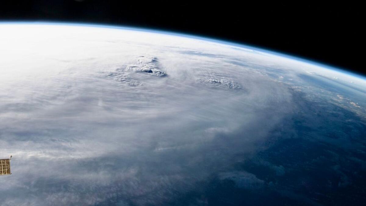
(MENAFN- Khaleej Times) Published: Thu 15 Jun 2023, 2:34 PM Last updated: Thu 15 Jun 2023, 3:09 PM
Tropical cyclone Biparjoy, affecting the Indian and Pakistani coasts, will weaken into a tropical storm in the next six hours, according to experts from the National Centre of Meteorology (NCM). The official explained that the cyclone's impact on UAE is limited as certain areas witnessed seawater entry over some low-lying beaches on the eastern coast and high tide periods.
Speaking to Khaleej Times on Thursday, Dr Ahmed Habib from the NCM said, "Its (Biparjoy) track will be to the north-northeast, towards the Indian - Pakistani coasts, where the wind speed ranges between 100 to 60 km/hour around the centre, moving with a speed of 8 km/hr. So, it is expected to weaken into a tropical storm in the next few hours by this evening. Karachi in Pakistan and north-east India at the moment are experiencing strong wind and heavy rains in the coastal areas."
He added,“But for the UAE, the cyclone is 150km from Fujairah. We only have long waves coming to our area. Our region is not experiencing any wind speed due to this. The wind, in general, in the coastal area is only moderate to fresh at times. So, the cyclone does not directly affect our region.”
Routine sea level alerts during summer Experts at the national weather forecasting agency also highlighted that sea level alerts issued earlier in the UAE are routine during summer.
Warnings were issued by authorities to beachgoers and against swimming as a result of an extended oceanic wave that surfaced from the depths of the Arabian Sea on Wednesday (yesterday), causing an inflow of seawater along the eastern coastline.
Dr Habib added,“This is not a flood situation. This is normal. On the east coast, there are some low-lying coastal areas. These places are lower than other places in the country. Yesterday we had long waves coming from the centre of the Arabia Sea towards our coastal areas in Fujairah.
At the same time, we also had high tide, the maximum height of the sea at a certain time. So, a combination of these factors led to the seawater influx on the east coast. Therefore, seawater spilled outside into the land area. But this hasn't happened in all the areas.”
He added,“This is quite common especially during summer. It's not unusual at all. This is only due to the easterly effect of the waves coming from the Arabian Sea during this time of the year. Typically, low-lying areas are affected by this tidal phenomenon.”
Meanwhile, the NCM has also urged the public not to spread rumours and to follow the weather bulletins issued by the centre.
“The easterly waves are being experienced due to the cyclone, but even at other times, we do see long waves like these. The only limited effect is the high waves on the eastern coast. The maximum recorded height of the waves has been six to seven feet. But this isn't much if you compare this to last summer when we recorded a height of nine feet on the east coast of the country. So, the cyclone is barely impacting the UAE,” he added.
ALSO READ:
cyclone biparjoy: uae's sultan alneyadi shares breathtaking new photos from space
uae weather alert: beaches battle seawater influx, residents told to avoid swimming
more than 100,000 evacuated as cyclone threatens india and pakistan
cyclone biparjoy off india, pakistan: what you need to know


Comments
No comment