


AI Maps Guide Dubai Police Patrols To Emergencies, Help Redistribute Coverage


- By: Arwa Almazrouei
When an emergency is reported, getting a police patrol to the scene involves more than finding the nearest vehicle. Traffic, access roads, and whether officers are already handling another incident can all affect how quickly help arrives.
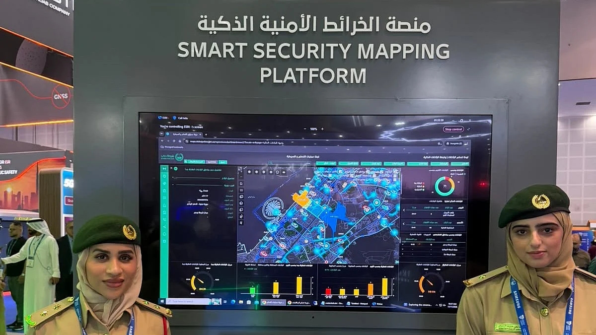
At the World Police Summit on Tuesday, November 17, Dubai Police demonstrated how artificial intelligence brings those factors together on a live map, guiding patrols to incidents and helping teams adjust coverage when an area becomes busy.
Recommended For You UAE National Day: 3-day Eid Al Etihad break announced for public sectorShowcased on the second day of the summit, the Smart Security Mapping Platform displays current reports alongside patrol locations, with AI suggesting routes to help officers reach emergencies faster.
Stay up to date with the latest news. Follow KT on WhatsApp Channels.
Second Lieutenant Hessa Al Muhairi explained that the platform uses mapping technology from Esri, a global geographic information systems company. During the demonstration, she pointed to reports appearing on the screen with timestamps matching the time of the presentation.
“These are live reports,” she said.
Finding the fastest way to helpThe platform does more than show where an incident has occurred. It suggests a route for responding patrols and identifies locations where patrols can position themselves to cover their areas better.
Al Muhairi said the system supports a three-minute response target for emergency reports.
The suggested positions help place patrols where they can respond effectively, while the mapping tools allow teams to consider access points and conditions that could affect their journey.
During the demonstration, the team explained that incident patterns, population density, and traffic density are among the factors considered when assessing patrol coverage.
When one patrol is already busyA report can arrive while the patrol responsible for that area is responding to another incident. The platform helps teams address that gap by adjusting coverage boundaries so neighboring patrols can assist.
Al Muhairi demonstrated how an area could be divided into smaller sections, allowing surrounding patrols to support a zone experiencing pressure.
The aim is to help teams respond to incidents that a busy patrol cannot immediately attend, while maintaining coverage across nearby areas.
Colour-coded indicators also give operators a quick view of patrol availability and response status.
Drones get assigned areasThe live mapping approach extends to drones, which operate within designated areas of responsibility, Al Muhairi explained. She described them as serving a role similar to patrols, but in the air.
Like vehicles on the ground, each drone has an assigned coverage area. Mapping those areas alongside patrol activity helps operators see how resources are distributed.
ALSO READ- Drone Box, AI analysis: Inside Dubai Police 999 emergency control room Dubai Police achieve 99.9% daytime safety rating, cut bureaucracy by 40% How Dubai airport teams protected passengers, set up shelter amid aerial threat in March

Legal Disclaimer:
MENAFN provides the
information “as is” without warranty of any kind. We do not accept any
responsibility or liability for the accuracy, content, images, videos,
licenses, completeness, legality, or reliability of the information
contained in this article. If you have any complaints or copyright issues
related to this article, kindly contact the provider above.


Comments
No comment