


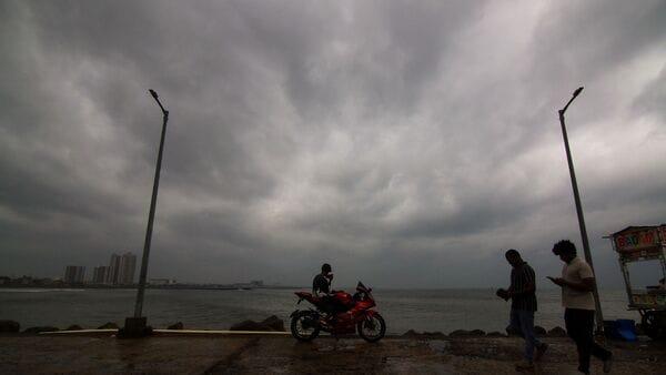
IMD Weather Update: Andhra, Odisha On High Alert As Third Cyclone Brews Over Bay Of Bengal In 3 Weeks


The India Meteorological Department (IMD), in its latest bulletin, said a well-marked low pressure has "intensified into a depression" over the Bay of Bengal and moved nearly northwards, laying centred 1,130 km south-southeast of Gopalpur in Odisha.
“It is very likely to move north-northwestwards, intensify further into a cyclonic storm over the central parts of the south and adjoining west-central Bay of Bengal on November 16 and into a severe cyclonic storm over the west-central Bay of Bengal on November 17,” the weather office said.
Also Read | Odisha braces for 3rd cyclone in three weeks; Andhra, Bengal on high alert: IMDThe system is likely to intensify further into a very severe cyclonic storm and move northwestwards towards the Andhra Pradesh coast during the subsequent two days, the IMD said, with maximum sustained surface wind speeds reaching 120-130 kmph, gusting up to 145 kmph.
Though the IMD has not forecast the landfall of the impending cyclone so far, Odisha has put all districts on alert“keeping in view the experience,” Disaster Management Minister Suresh Pujari said.
Also Read | Heavy rain, snowfall alerts across India till Nov 16; Delhi's AQI improves IMD issues heavy rainfall alertMultiple states are on high alert for severe weather disruptions as the cyclone approaches the coast:
-
Coastal Andhra Pradesh: Heavy to very heavy rainfall is expected, with isolated extremely heavy rainfall (≥21 cm) predicted for November 19 and 20. Gale winds along the coast will accelerate to 120-130 kmph (gusting to 145 kmph) by the evening of November 19.
Odisha: Light to moderate rainfall will begin on November 18, intensifying into heavy and very heavy downpours in isolated areas from November 19 to 21.
Tamil Nadu, Puducherry & Karaikal: Heavy to very heavy rainfall is forecast at isolated places on November 18 and 19.
States including Telangana, Chhattisgarh, and Jharkhand will also experience light to moderate rainfall with isolated heavy showers between November 19 and 21.
West Bengal: Heavy rain is likely in coastal districts of South 24 Parganas and Purba Medinipur from November 19 to 21. A downpour is expected in the southern districts of Howrah, Paschim Medinipur and Jhargram on November 20 and 21. According to the IMD, thunderstorms accompanied by winds of up to 40 km per hour are also likely in Kolkata and most districts of Gangetic West Bengal.
Authorities are bracing for significant infrastructural and agricultural impacts across the affected urban and rural belts.
The cyclone is expected to cause localised flooding of roads, closure of underpasses, and severe waterlogging in low-lying areas. Minor damage to kutcha roads and significant damage to horticulture and standing crops due to inundation are highly likely.
Marine warningFishermen have been strictly advised to return to the coast immediately. All maritime and fishing activities are suspended, and crews are warned not to venture into the Andaman Sea or the Bay of Bengal through November 20 due to "phenomenal" and highly dangerous sea conditions.
(With PTI inputs)

Legal Disclaimer:
MENAFN provides the
information “as is” without warranty of any kind. We do not accept any
responsibility or liability for the accuracy, content, images, videos,
licenses, completeness, legality, or reliability of the information
contained in this article. If you have any complaints or copyright issues
related to this article, kindly contact the provider above.


Comments
No comment