


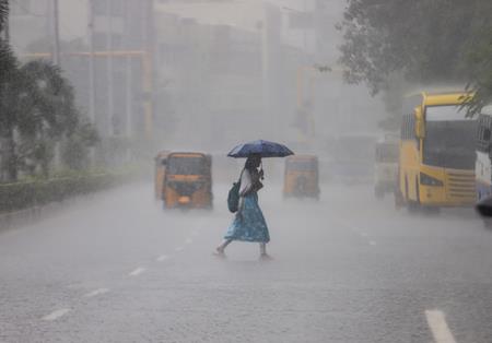
Fresh Weather System May Bring Heavy Rain In Chennai On November 1-2


The forecast comes shortly after Cyclone Arnab moved past Tamil Nadu towards Andhra Pradesh and further north, giving Chennai a brief respite from concerns over its impact.
Attention has now shifted to conditions developing over the Bay that could favour another low-pressure system. Weather experts said the prospective system could strengthen and move towards northern Tamil Nadu. If it develops into a cyclone, a coastal crossing between Chennai and Andhra Pradesh is a possibility. However, neither cyclone formation nor a landfall location can be confirmed at this stage.
Dr V.R. Durai, Director of the Regional Meteorological Centre, Chennai, said current prediction models indicated movement towards the northern parts of Tamil Nadu, but cautioned that the system's eventual course could not yet be accurately determined.
“Before the system intensifies into a cyclone, it is difficult to determine precisely which direction it will take and how it will move. However, current weather prediction models indicate that it could move towards the northern parts of Tamil Nadu,” he said.
Durai explained that rainfall prospects for different parts of the state would depend on the system's movement after strengthening. A shift towards the Cauvery Delta could bring good rainfall to Tamil Nadu, while movement towards Chennai and the adjoining Andhra Pradesh coast could result in significant rain over the city.
The possible rainfall spell on November 1 and 2, therefore, remains linked to how the system develops and the route it subsequently takes. The indications available now offer an early assessment of potential weather activity rather than a definite forecast of a cyclone striking Chennai.
A clearer picture of the likely track and its implications for rainfall would emerge only after the system intensifies and its movement becomes better defined, Durai said.
For Chennai, the key uncertainty is whether the developing system will approach the northern Tamil Nadu coast or take a different course. That distinction will shape the city's rainfall prospects, while any movement towards the Delta would alter the geographical focus of the expected rain. The assessment remains provisional pending further development of the system.

Legal Disclaimer:
MENAFN provides the
information “as is” without warranty of any kind. We do not accept
any responsibility or liability for the accuracy, content, images,
videos, licenses, completeness, legality, or reliability of the information
contained in this article. If you have any complaints or copyright
issues related to this article, kindly contact the provider above.


Comments
No comment