


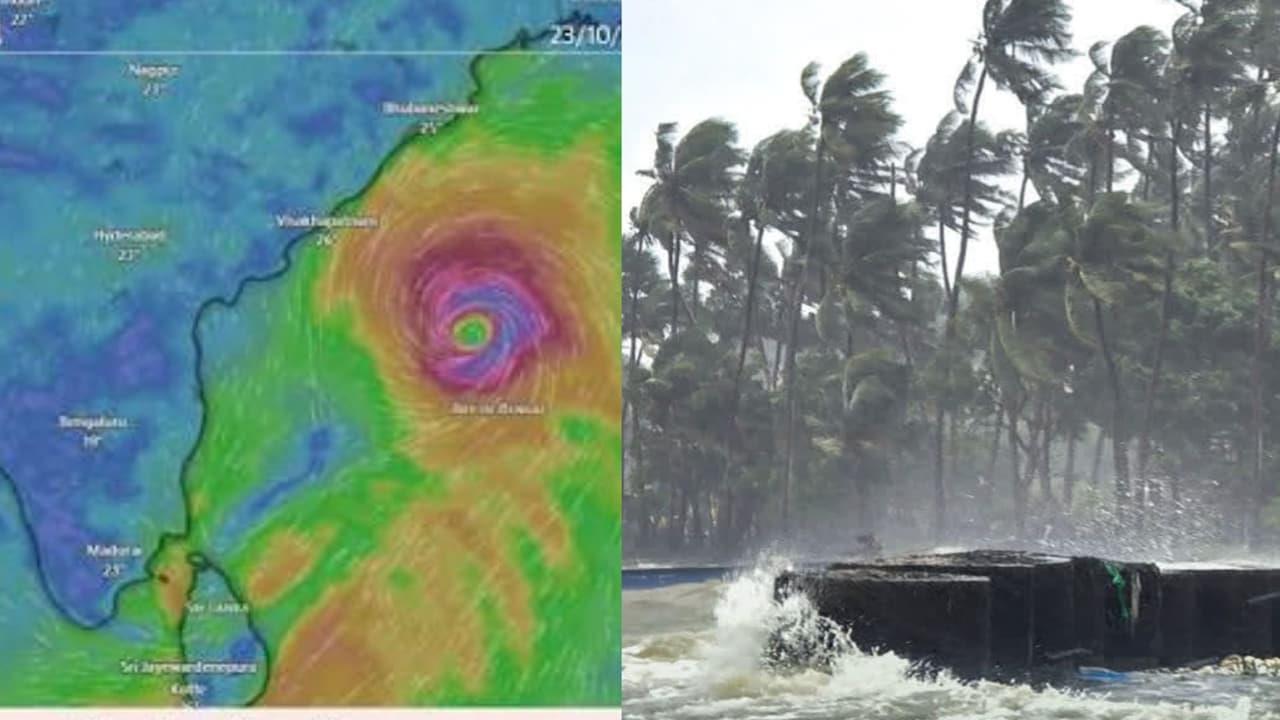
Cyclone Arnab Alert: These Odisha, Andhra Pradesh Districts Face Flood, Landslide Risk


Andhra Pradesh and Odisha are on alert as Cyclone Arnab intensifies over the Bay of Bengal, raising concerns about heavy rainfall, strong winds and flooding along the eastern coast. The India Meteorological Department (IMD) has flagged October 27 to 29 as a crucial period, with October 28 emerging as a possible landfall date in forecasts issued on October 25 and 26.
Andhra Pradesh could face the greater impact if the cyclone makes landfall along its coast, while southern Odisha remains vulnerable to heavy rain, flash floods and landslides in hilly areas. The cyclone's eventual path and intensity will determine the severity of the impact.
Cyclone Arnab Update: IMD Tracks Intensifying Bay Of Bengal System
According to the IMD's coastal weather bulletin issued on October 25, the weather system was a deep depression over the east-central and adjoining southeast Bay of Bengal. It intensified into a cyclonic storm in the early hours of October 26, with further strengthening forecast as it moves across the Bay.
The system is expected to move westward before turning northwestward, bringing it closer to the Andhra Pradesh coast. Forecasts issued on October 25 and 26 indicated a possible landfall between Bapatla and Visakhapatnam on October 28.
However, the projected path and intensity can change as the cyclone develops. Residents should follow the latest IMD bulletins for updated landfall estimates, wind warnings and rainfall forecasts.
Andhra Pradesh Districts On Alert As Heavy Rain Raises Flood Concerns
Andhra Pradesh could face the most significant impact if Cyclone Arnab crosses the coast along the projected stretch between Bapatla and Visakhapatnam. Coastal and adjoining districts near the anticipated landfall zone may experience intense rainfall, strong winds and disruptions to normal life.
Heavy downpours can lead to waterlogging in urban areas, swollen streams and rivers, and flash flooding in low-lying locations. Strong winds could also damage trees, power lines and temporary structures, potentially disrupting electricity and transport services.
Districts along the projected landfall corridor, including areas around Bapatla, Krishna, NTR, Guntur, Eluru, West Godavari, Kakinada, Konaseema, Visakhapatnam and Anakapalli, should monitor official district-level advisories closely. The actual impact will depend on the cyclone's final track, and this list should not be treated as a confirmed district-wise IMD warning.
Residents in vulnerable areas should avoid crossing flooded roads and streams, secure loose objects outdoors and follow evacuation instructions issued by local authorities.
Southern Odisha Faces Heavy Rain, Flash Flood And Landslide Risks
Although Andhra Pradesh is closer to the projected landfall zone, southern Odisha could also experience significant weather-related disruption as the cyclone approaches the eastern coast.
Intense rainfall may cause waterlogging and flash flooding, particularly in low-lying areas and locations near rivers and streams. Hilly and landslide-prone terrain in southern Odisha could face additional risks if heavy rain persists over several hours.
Districts such as Gajapati, Ganjam, Rayagada, Koraput, Malkangiri and Kandhamal should pay close attention to official rainfall warnings and local administration updates. These are areas to monitor for potential rain-related impacts, not a confirmed list of districts under a specific IMD alert.
The period from October 27 to 29 could prove particularly important as the system strengthens and approaches the coast. Residents should keep track of updated weather bulletins, avoid unnecessary travel during intense rainfall and stay away from vulnerable slopes and overflowing water channels.
For both states, the cyclone's precise track, landfall location and intensity will determine which districts experience the worst conditions. Residents should rely on the IMD and state disaster management authorities for the latest warnings and safety instructions.

Legal Disclaimer:
MENAFN provides the
information “as is” without warranty of any kind. We do not accept
any responsibility or liability for the accuracy, content, images,
videos, licenses, completeness, legality, or reliability of the information
contained in this article. If you have any complaints or copyright
issues related to this article, kindly contact the provider above.


Comments
No comment