

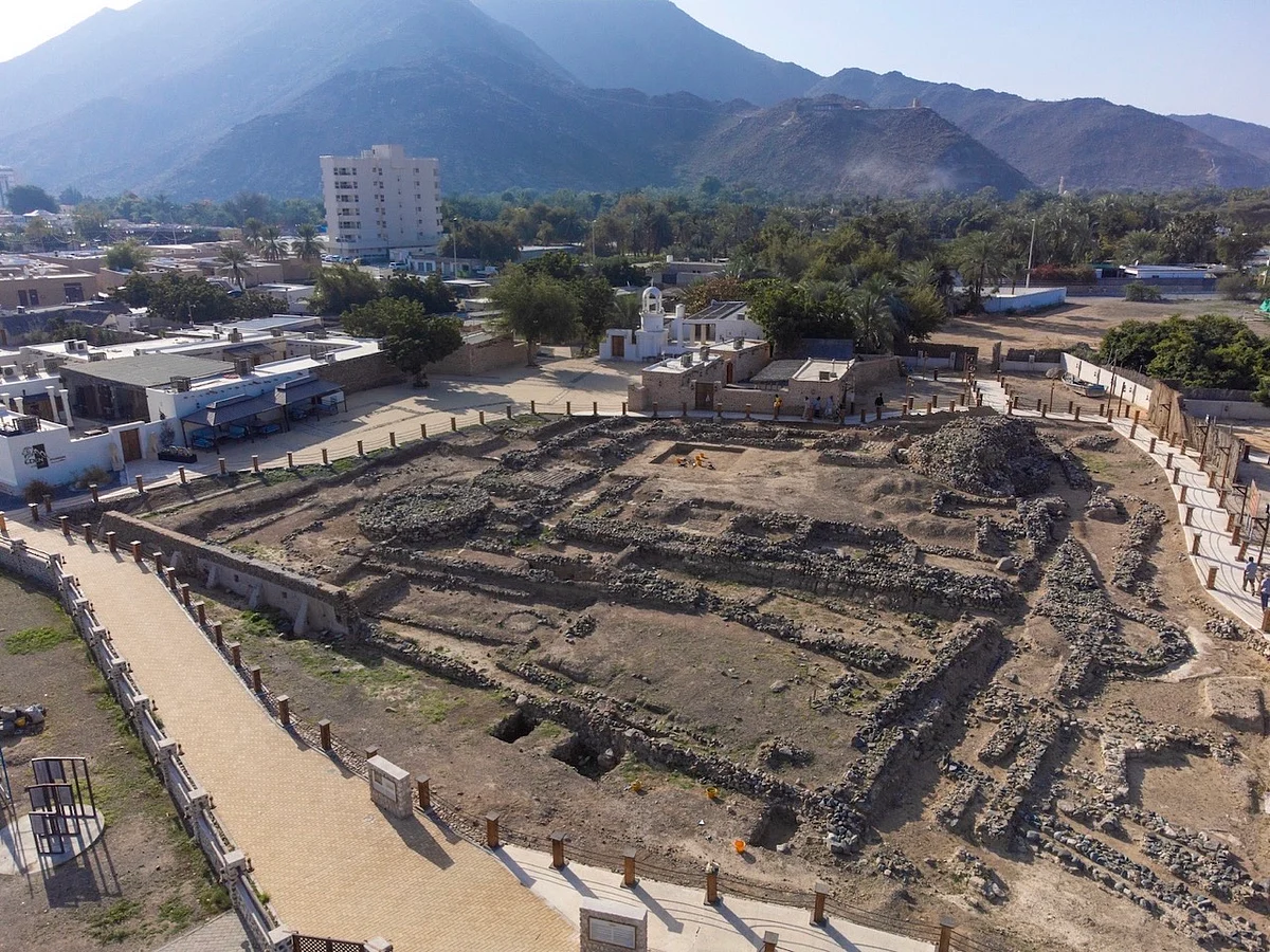
Sharjah's Coastal Network Of Dibba Al Hisn, Khor Fakkan, Khor Kalba Added To UNESCO List


The coastal network comprises three interconnected cultural heritage components: Dibba Al-Hisn, Khor Fakkan and Khor Kalba. Together, these sites formed across successive historical periods a strategic maritime corridor along the Oman Sea.
Recommended For YouThey preserve archaeological and architectural evidence of the vital role played by coastal communities in maritime trade, navigation, defence and coastal administration, while illustrating the transformation of maritime authority and commercial exchange across the western Indian Ocean.
Stay up to date with the latest news. Follow KT on WhatsApp Channels.
The new addition brings the total number of UAE sites on the list to 16, including six in Sharjah, reflecting the range of the emirate's scientific and institutional efforts to showcase its archaeological and cultural significance internationally while preparing its heritage sites in accordance with World Heritage standards.
The network documents a history spanning more than two millennia, beginning with its ports' integration into Indian Ocean trade networks, continuing through the era of the Kingdom of Hormuz and the Portuguese presence during the sixteenth and seventeenth centuries. It also culminates in the local administration of these sites under Al Qasimi authority as part of a regional system governing navigation, trade and coastal management.
Sheikha Bodour bint Sultan Al Qasimi, UNESCO Goodwill Ambassador for Education and Book Culture and Ambassador of the Faya World Heritage Property, said, "The inclusion of six sites from Sharjah among the UAE's 16 sites on UNESCO's Tentative List reflects an integrated cultural project that views heritage not merely as evidence of the past, but as knowledge and a responsibility that extends into the future."
"Every site we study, document and preserve adds a new chapter to our understanding of the history of this land, while offering the world a broader window into the region's role in trade, connectivity and cultural exchange across the centuries. This standing is rooted in the long-term vision of Sheikh Dr Sultan bin Mohammed Al Qasimi, Supreme Council Member and Ruler of Sharjah, who established scientific research and heritage conservation as integral pillars of the emirate's cultural project."
She also added: "The significance of this achievement goes beyond the number of sites included on the Tentative List. It lies in building a sustainable system capable of studying, protecting and presenting our heritage to the world according to the highest scientific standards, ensuring that these sites remain part of humanity's shared memory and that their knowledge and value are passed on to future generations."
Prominence of Dibba Al-HisnDibba Al-Hisn forms the northern component of the proposed serial property, occupying a strategic location on Dibba Bay at the southern edge of the Musandam Peninsula.
Archaeological excavations at Dibba Fort have revealed successive archaeological layers documenting settlement from the Neolithic period through to the twentieth century, alongside the remains of fortifications and structures associated with production, trade and coastal life.
These include glass-working workshops where imported Roman and Mesopotamian ingots were re-melted to produce local vessels, twelve madābis used for date processing, pearl-processing installations, and a nineteenth-century fish-salting facility. These discoveries demonstrate Dibba's historical significance as an inhabited and productive settlement that was deeply connected to long-distance trade networks.
Historical and archaeological evidence further points to Dibba's early importance within Indian Ocean exchange networks and its role in trade routes linking the Arabian Peninsula with Persia, India, East Africa and the Mediterranean, before later becoming one of the principal components of the fortified coastal system reorganised under Al Qasimi authority.
Khor Fakkan's naturally sheltered harbourThe central component of the serial property, Khor Fakkan occupies one of the most naturally sheltered harbours along the eastern coast of the Arabian Peninsula, where the Hajar Mountains descend directly to the sea to create a protected bay that played a pivotal role in maritime navigation and trade.
Archaeological investigations have identified two principal fortified sites in Khor Fakkan: the East Fort and the West Fort, together with settlement layers and stone-built houses dating to the fifteenth and early sixteenth centuries, as well as a surviving section of the historic town wall extending for more than 155 metres.
The West Fort preserves three superimposed phases of fortification that reflect successive periods of maritime control. The earliest is distinguished by its triangular plan and is interpreted as a seventeenth-century Portuguese fortification. This was followed by a rectangular structure dating to the latter half of the eighteenth century, corresponding to a period of Arab consolidation, and subsequently by a square fort with a round tower dating to the nineteenth century under Al Qasimi rule.
Together, these successive phases document Khor Fakkan's changing strategic role and its development into a principal harbour under Al Qasimi rule, linking maritime traffic along the Oman Sea with inland routes across the Hajar Mountains.
Khor Kalba's support to maritime navigationKhor Kalba represents the southern component of the serial property and is situated on a sandy coastal plain at the mouth of Kalba Creek, within a broader coastal environment comprising the creek, shallow water bodies, and surrounding mangrove forests.
Historical sources indicate that Kalba was a fortified settlement belonging to the Kingdom of Hormuz before it was taken by the Portuguese in 1624. The Portuguese subsequently constructed a rammed-earth fortification on stone foundations, designed to support navigation, trade, and maritime supply operations.
Archaeological excavations have revealed the remains of this fortification, which consists of a quadrangular enclosure wall, two circular corner towers, and a main entrance on the southern side.
Following the decline of Portuguese influence, Kalba became part of the maritime sphere of the Al Qawasim and played a pivotal role in supply operations, defence, and the regulation of maritime movement along the coast of the Gulf of Oman.
Despite the transformations witnessed across the centuries, all three sites continue to preserve key evidence of this shared history, from fortifications and settlement remains to harbours and the surrounding coastal landscapes.
The survival of these features, and the relationships between them, provides a clear understanding of the network's historical development, demonstrating how ports, defensive structures and coastal communities operated together as a single integrated system along the Oman Sea.
The new inscription builds on Sharjah's long-standing commitment to archaeological research, heritage conservation and bringing its historic sites to international attention. This journey culminated in July 2025 with the inscription of the Faya Palaeolandscape on the UNESCO World Heritage List, making it the second site in the UAE at the time to receive this global recognition, after the Cultural Sites of Al Ain (Hafit, Hili, Bidaa Bint Saud and Oases Areas), which were inscribed in 2011.
ALSO READ- From 60,000-year-old human traces to Bronze Age tomb: UAE's top 2026 archaeological finds What sets Unesco-listed Wadi Wurayah apart? UAE official details 20-year journey UAE official shares top spots for visitors at Unesco-listed Wadi Wurayah

Legal Disclaimer:
MENAFN provides the
information “as is” without warranty of any kind. We do not accept any
responsibility or liability for the accuracy, content, images, videos,
licenses, completeness, legality, or reliability of the information
contained in this article. If you have any complaints or copyright issues
related to this article, kindly contact the provider above.
Comments
No comment