

403
Sorry!!
Error! We're sorry, but the page you were looking for doesn't exist.
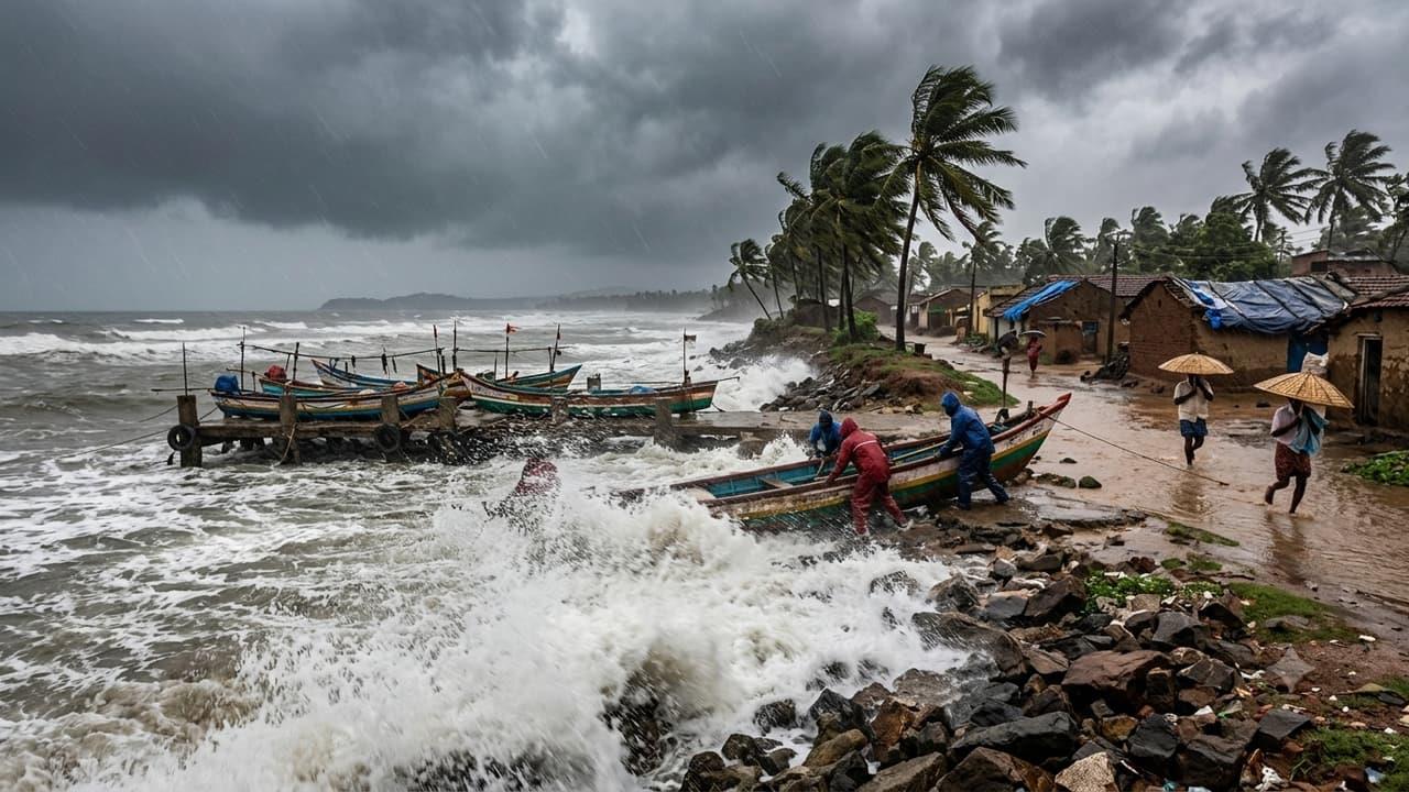
AP Telangana Weather: 4 Pacific Storms Brewing, Sudden Showers May Follow Sunshine Check Forecast


(MENAFN- AsiaNet News) ![]() The weather in the Telugu states is changing really fast. The IMD says that wind directions have shifted over the Bay of Bengal and the Arabian Sea, creating some unusual weather. The rains we've seen recently might be easing up, but September 4 will bring a mixed bag. Expect the heat to rise, but don't be surprised by sudden, sharp showers.
The weather in the Telugu states is changing really fast. The IMD says that wind directions have shifted over the Bay of Bengal and the Arabian Sea, creating some unusual weather. The rains we've seen recently might be easing up, but September 4 will bring a mixed bag. Expect the heat to rise, but don't be surprised by sudden, sharp showers.![]() The intense low-pressure system over Madhya Pradesh is now moving west. This means its impact on Andhra Pradesh and Telangana is slowly reducing. On September 4, both states will likely see dry weather and high temperatures. You might see some heavy clouds passing by, but the chances of major rainfall are low. Still, some moisture from the southwest monsoon could bring a few scattered showers.
The intense low-pressure system over Madhya Pradesh is now moving west. This means its impact on Andhra Pradesh and Telangana is slowly reducing. On September 4, both states will likely see dry weather and high temperatures. You might see some heavy clouds passing by, but the chances of major rainfall are low. Still, some moisture from the southwest monsoon could bring a few scattered showers.![]() A cyclonic circulation has joined the low-pressure system, pushing clouds up to 7.6 km high. One monsoon trough runs from Madhya Pradesh to the northeast Bay of Bengal, while another stretches from the Arabian Sea to Gujarat and Madhya Pradesh. Winds are hitting 60 km/h in the Arabian Sea and 40 km/h in the Bay of Bengal. Expect gusty winds of 35 km/h on the AP coast and 30 km/h in Telangana. Max temps will be around 36°C in AP and 33°C in Telangana. Humidity will be 60% in North Andhra, 42% in Coastal and Rayalaseema, and 55% in Telangana.
A cyclonic circulation has joined the low-pressure system, pushing clouds up to 7.6 km high. One monsoon trough runs from Madhya Pradesh to the northeast Bay of Bengal, while another stretches from the Arabian Sea to Gujarat and Madhya Pradesh. Winds are hitting 60 km/h in the Arabian Sea and 40 km/h in the Bay of Bengal. Expect gusty winds of 35 km/h on the AP coast and 30 km/h in Telangana. Max temps will be around 36°C in AP and 33°C in Telangana. Humidity will be 60% in North Andhra, 42% in Coastal and Rayalaseema, and 55% in Telangana.![]() The Hyderabad IMD says high humidity could trigger evening showers in several Telangana districts. Adilabad, Kumrambheem Asifabad, and Mancherial might see moderate rain by the afternoon. By evening, Narayanpet, Jogulamba Gadwal, Nagarkurnool, Nalgonda, Suryapet, Khammam, Bhadradri Kothagudem, Jayashankar Bhupalpally, and Peddapalli can expect rain. Hyderabad itself might get light to moderate showers in the evening or at night. Meanwhile, in AP, Coastal Andhra and Rayalaseema will see strong winds of 40-50 km/h with scattered light rains today and tomorrow.
The Hyderabad IMD says high humidity could trigger evening showers in several Telangana districts. Adilabad, Kumrambheem Asifabad, and Mancherial might see moderate rain by the afternoon. By evening, Narayanpet, Jogulamba Gadwal, Nagarkurnool, Nalgonda, Suryapet, Khammam, Bhadradri Kothagudem, Jayashankar Bhupalpally, and Peddapalli can expect rain. Hyderabad itself might get light to moderate showers in the evening or at night. Meanwhile, in AP, Coastal Andhra and Rayalaseema will see strong winds of 40-50 km/h with scattered light rains today and tomorrow.![]() Globally, the El Niño effect has superheated the Pacific Ocean. Right now, 4 typhoons and 3 low-pressure systems are active there. Typhoon Lowell is the most dangerous, with winds hitting 220 km/h. Typhoon Marie has winds of 155 km/h, and Typhoon Karina is at 150 km/h. Near China, Typhoon Krowanh is spinning at 75 km/h. Experts warn that as El Niño gets stronger, we could see even more storms forming.
Globally, the El Niño effect has superheated the Pacific Ocean. Right now, 4 typhoons and 3 low-pressure systems are active there. Typhoon Lowell is the most dangerous, with winds hitting 220 km/h. Typhoon Marie has winds of 155 km/h, and Typhoon Karina is at 150 km/h. Near China, Typhoon Krowanh is spinning at 75 km/h. Experts warn that as El Niño gets stronger, we could see even more storms forming.![]() Extreme heat and cloud cover are affecting the equatorial region and even Antarctica. Experts predict that this September, despite sudden rains, we'll face summer-like heat and humidity. This will be especially uncomfortable in AP's coastal areas. Since widespread rains aren't expected, there could be a shortage of irrigation water for crops. Analysts advise farmers not to rely only on rain and to get alternative irrigation methods ready.
Extreme heat and cloud cover are affecting the equatorial region and even Antarctica. Experts predict that this September, despite sudden rains, we'll face summer-like heat and humidity. This will be especially uncomfortable in AP's coastal areas. Since widespread rains aren't expected, there could be a shortage of irrigation water for crops. Analysts advise farmers not to rely only on rain and to get alternative irrigation methods ready.
AP and Telangana weather update: Rain activity is likely to continue across parts of the two states, with sunshine and sudden showers possible. Check the latest forecast, rain alerts and weather conditions.

Legal Disclaimer:
MENAFN provides the
information “as is” without warranty of any kind. We do not accept any
responsibility or liability for the accuracy, content, images, videos,
licenses, completeness, legality, or reliability of the information
contained in this article. If you have any complaints or copyright issues
related to this article, kindly contact the provider above.
Comments
No comment