(MENAFN- UkrinForm) Maxar Technologies has released the latest satellite imagery of the Kakhovka HPP destroyed by Russian troops. The photos show the dam destroyed by the Russian occupiers and the flooded surroundings.
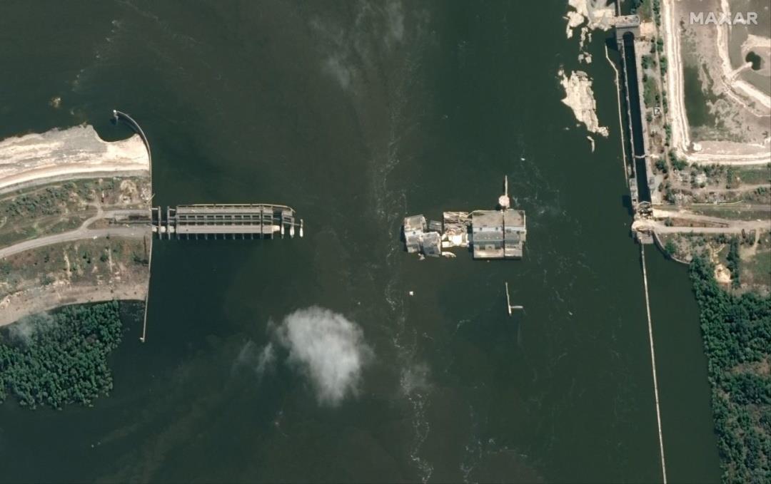
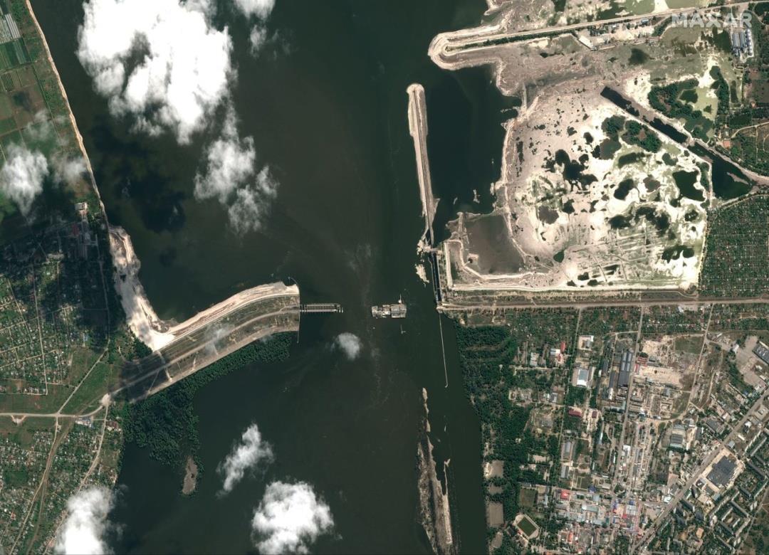
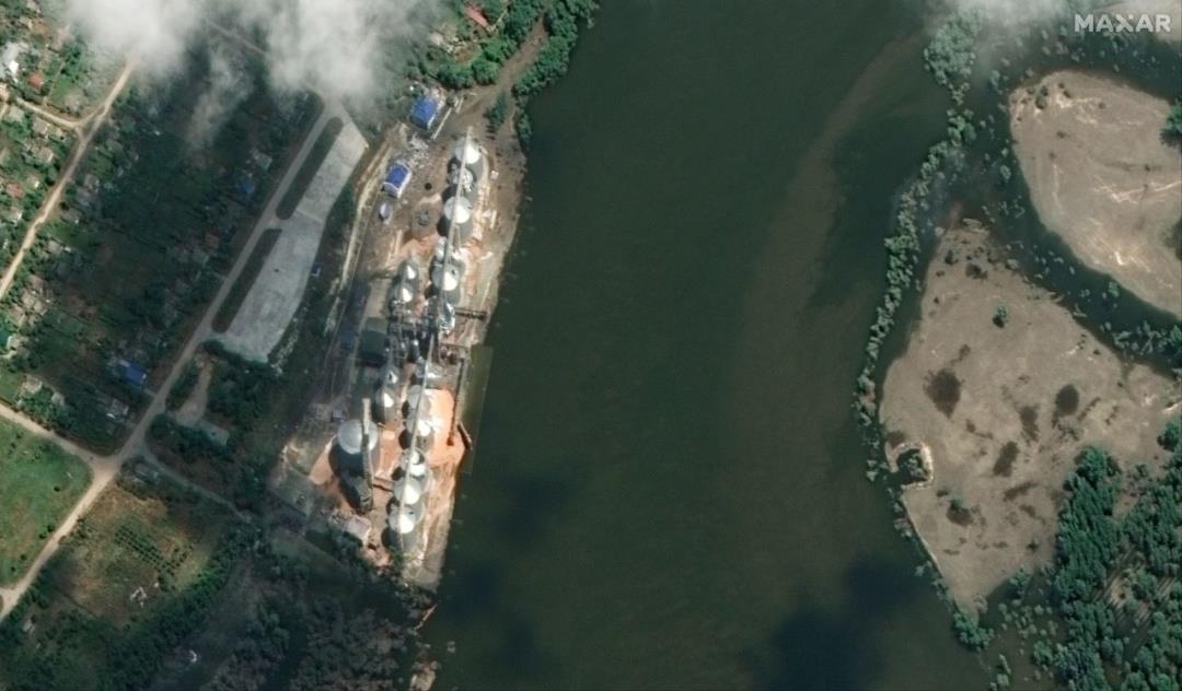
One of the pictures also shows the Nibulon river terminal in the urban-type village of Kozatske, not far from the blown-up hydroelectric power plant.
Earlier, the terminal was completely flooded, but the latest satellite images indicate that the water level has begun to decrease.
As reported, on the night of June 6, Russian troops blew up the dam of the Kakhovka HPP, causing large-scale flooding of the territories of Kherson region. Part of Mykolaiv region was also affected by flooding. In Zaporizhzhia and Dnipropetrovsk regions, the water level in the Dnipro River has decreased.
Read also: kakhovka hpp explosion: 54 settlements in three regions remain flooded In particular, in Zaporizhzhia, as of June 16, the water in the lower bay fell by 3.75 meters. Now its level is one meter lower than normal.
Photos: Maxar Technologies
MENAFN17062023000193011044ID1106449790
Legal Disclaimer:
MENAFN provides the
information “as is” without warranty of any kind. We do not accept
any responsibility or liability for the accuracy, content, images,
videos, licenses, completeness, legality, or reliability of the information
contained in this article. If you have any complaints or copyright
issues related to this article, kindly contact the provider above.








Comments
No comment