(MENAFN- Asia Times)
JAKARTA – Overcrowded Java is counting the cost of another eruption that has claimed at least 22 lives and displaced thousands of villagers living around the slopes of the 3,700-meter-high Mount Semeru, the island's tallest peak and bookend for a long line of menacing volcanoes.
With 27 missing, the death toll is expected to rise as the latest in Indonesia's unending natural disasters cut power supplies and destroyed a key bridge linking Lumajang, an Indian Ocean town south of Semeru, and the neighboring East Java city of Malang.
Volcanologists blamed the December 4 eruption on heavy rain, which they said caused the lip of Semeru's crater to collapse, sending avalanches of super-heated rock and gas, known as pyroclastic flows, surging down the slopes into surrounding villages.
Although the volcano was on alert level 2 before the destabilization of the lava dome, there had been few seismic tremors to indicate the presence of magma bubbling beneath the surface, which normally warns of an impending blow-out.
The eruption serves as yet another reminder of the danger presented by Indonesia's 76 historically-active volcanoes, 24 of which are located on Java and Bali and 13 on Sumatra. Semeru is one of 59 that are under constant monitoring.
Lying at the convergence of four tectonic plates, Indonesia is second only to Japan in the number of recorded eruptions but has suffered the highest casualties from lahars, pyroclastic flows and tsunamis, and the most evacuations.
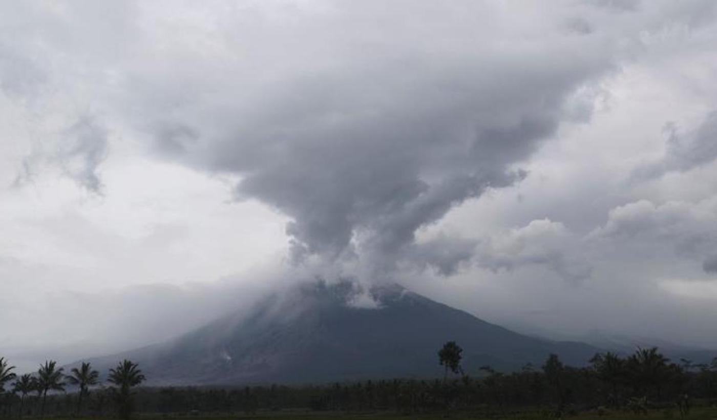
Mount Semeru releases volcanic materials during an eruption as seen from Lumajang district, East Java province, Indonesia, Monday, December 6, 2021. Photo: Screengrab / CNN
What makes disaster planning difficult is that any explosive eruption on the scale of the Pinatubo event in the Philippines in 1991 would not only mean mass evacuations but also deal a heavy blow to Java's economy and infrastructure.
About four million Java residents live in high-risk areas marked red or yellow on hazard zoning maps and 10 million would have to be relocated in serious emergencies. Across the country, about 20% of the population is in a volcano's path.
Semeru has erupted 66 times going back to 1867, with the heaviest death toll recorded in 1981 when rain-loosened debris from a string of previous events, cascaded down two rivers leading away from the mountain, killing 372 villagers.
Since then, 10 people have died in eruptions, including two members of an international scientific team in July 2000. Only three months earlier, Australian volcanologist John Seach had dodged lava bombs and brown ash clouds on an expedition to Semeru's summit.
In a comprehensive report to the Washington-based Smithsonian Institute, which chronicles volcanoes around the world, Seach says he warned of the many hazards that would ultimately claim the lives of his fellow volcanologists.
Like Seremu, Central Java's Mount Merapi 280 kilometers to the west, may erupt more than most other peaks, but it is largely predictable – something that can't be said about some of Java's dormant volcanoes, which are potentially far more dangerous.
“There is a rule of thumb in volcanology that the longer a volcano remains dormant, the more dangerous an eruption may be when it awakens,” says Seach, who sees his work as not to predict eruptions but to foresee hazardous events.
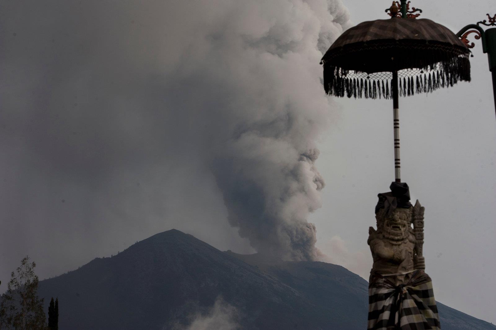
Mount Agung's eruption as seen from Besakih temple in Karangasem, Bali, Indonesia November 28, 2017. Photo: Antara Foto
The massive 1991 Pinatubo eruption in the Philippines is a classic illustration of the explosive power of a newly-awakened volcano that lay silent for six centuries and which only recently has shown signs of coming back to life after 30 years of inactivity.
Pinatubo, in fact, had not even been on the Manila government's active watch list despite its location on the main island of Luzon, with its current 64.2 million population, about a third of them in the central region.
That eruption was the biggest in a populated area since West Java's fabled Krakatau blast in 1883, with lahars surging through villages and towns and transforming the countryside into an ash-covered moonscape over a 40-kilometer radius of central Luzon.
At least 350 people died – on top of the 1,660 who perished in the 7.8 earthquake that had struck northern Luzon a year earlier and triggered a shift in the tectonic fault line running through the center of the volcano.
Disease subsequently killed 372 in evacuation camps set up to shelter 300,000 people left homeless as ash deposits built to as much as 50 meters thick. It would take almost a decade for the region to recover.
Historically, long before volcanology became a more exact science, it was difficult to predict the behavior of a volcano. Merapi, for example, has taken at least 4,600 lives in recorded history, including an estimated 3,000 in 1672.
Even then, volcanoes remain notoriously unpredictable. The heaviest recent death toll on Merapi was in 1994 when 66 villagers were buried in a pyroclastic flow that unusually spilled down the western side of the 2,900-meter peak, 35 kilometers north of Jogjakarta.
Traveling at up to 700 kilometers per hour (kph), the fiery avalanches pose a greater danger than slow-moving lava, burying everything in their path and claiming additional victims with their toxic gases.
Semeru is one of 65 volcanoes that the Directorate of Volcanology keeps a constant eye on across the archipelago. All told, however, Indonesia has 76 historically-active volcanoes, or 13% of the world's total.
Krakatau, standing in the Sunda Strait between Java and Sumatra, has sounded off numerous times following the devastating 1883 eruption, whose 10-meter-high tsunami waves killed 36,000 people in an explosion heard and felt around the world.
In December 2018, 426 coastal dwellers died when the southwest side of Krakatau's caldera collapsed after decades of activity that had gone on since a new island volcano broke the surface in 1927 and began the process of rebuilding itself.
Krakatau and Tambora, on the eastern island of Sumbawa, are among 11 of the 14 most explosive eruptions in the last two centuries – or those that discharged more than one cubic kilometer of material – which were first-time events.
Then there are ticking time bombs like Kelud, 70 kilometers west of Semeru, which has erupted 36 times and killed an estimated 15,500 people since a major event in 1586 that left 10,000 dead and obscured the sun for three days.
Mount Kalud in a file photo. Photo: Smithsonian
The latest eruption, in February 2014, claimed only three lives, but the heavy ashfall forced the evacuation of 76,000 people, closed seven airports across Java and caused widespread damage to apple orchards and East Java's dairy industry.
Kelud's greatest danger has always been its crater lake – a feature not found in many of Indonesia's volcanoes. Water and molten magma are an explosive mixture and make damaging mudflows inevitable, as was the case with Pinatubo.
In the 1950s, engineers dug a tunnel to reduce the volume of water in the lake. But volcanologists still worry, noting that 25 meter-high lahars spread 30 kilometers to the south in eruptions in 1919 and again in 1966.
These days, it would put towns like Blitar, founding president Sukarno's hometown, at risk.
MENAFN07122021000159011032ID1103316583